Automatic Point Cloud Classification
1. Description
The "Automatic Point Cloud Classification" analytics is optimized for the power and utilities industry. It semantically segments, i.e. classifies, a point cloud, running as a fully automatic self-service analytic triggered by the user. Let's review the process to obtain and view a classified point cloud with this analytics.
2. Prerequisites
A survey containing a point cloud (.las) without classification or carrying an anterior classification will be overridden during the process.
3. Workflow
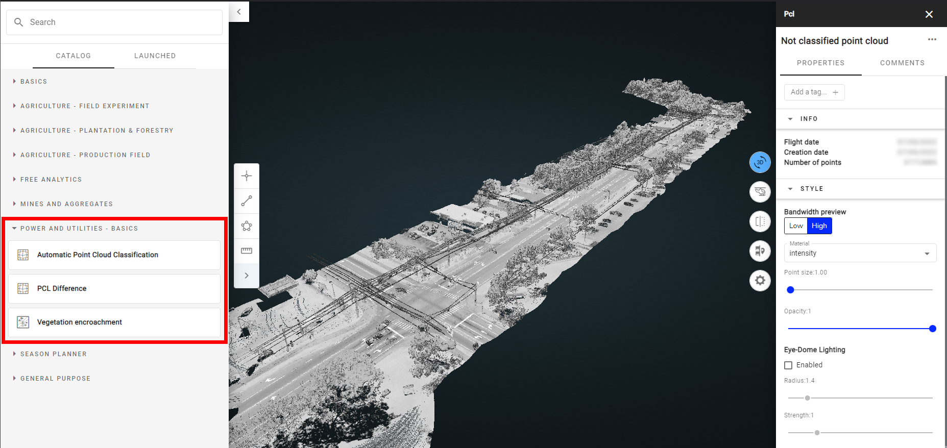
Step 1 - Select the survey and from the Analytics tab search and select "Automatic point cloud classification".
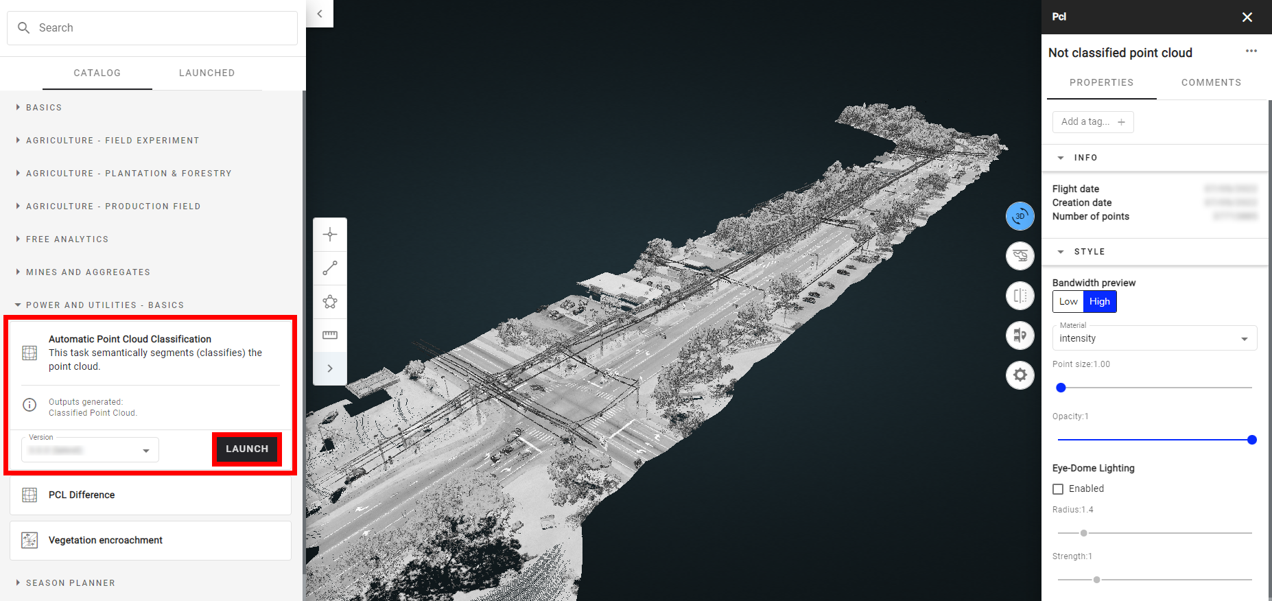
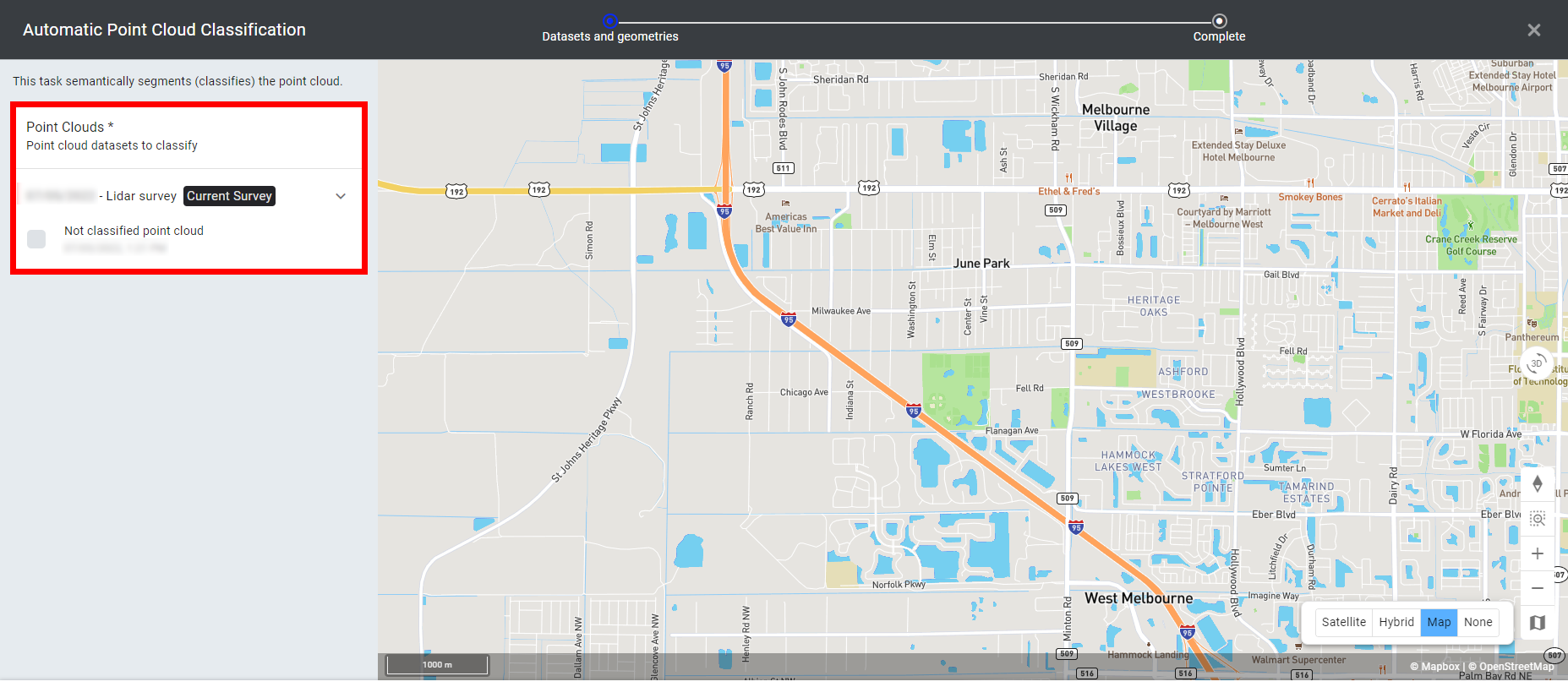
Step 4 - Click on "LAUNCH AUTOMATIC POINT CLOUD CLASSIFICATION".
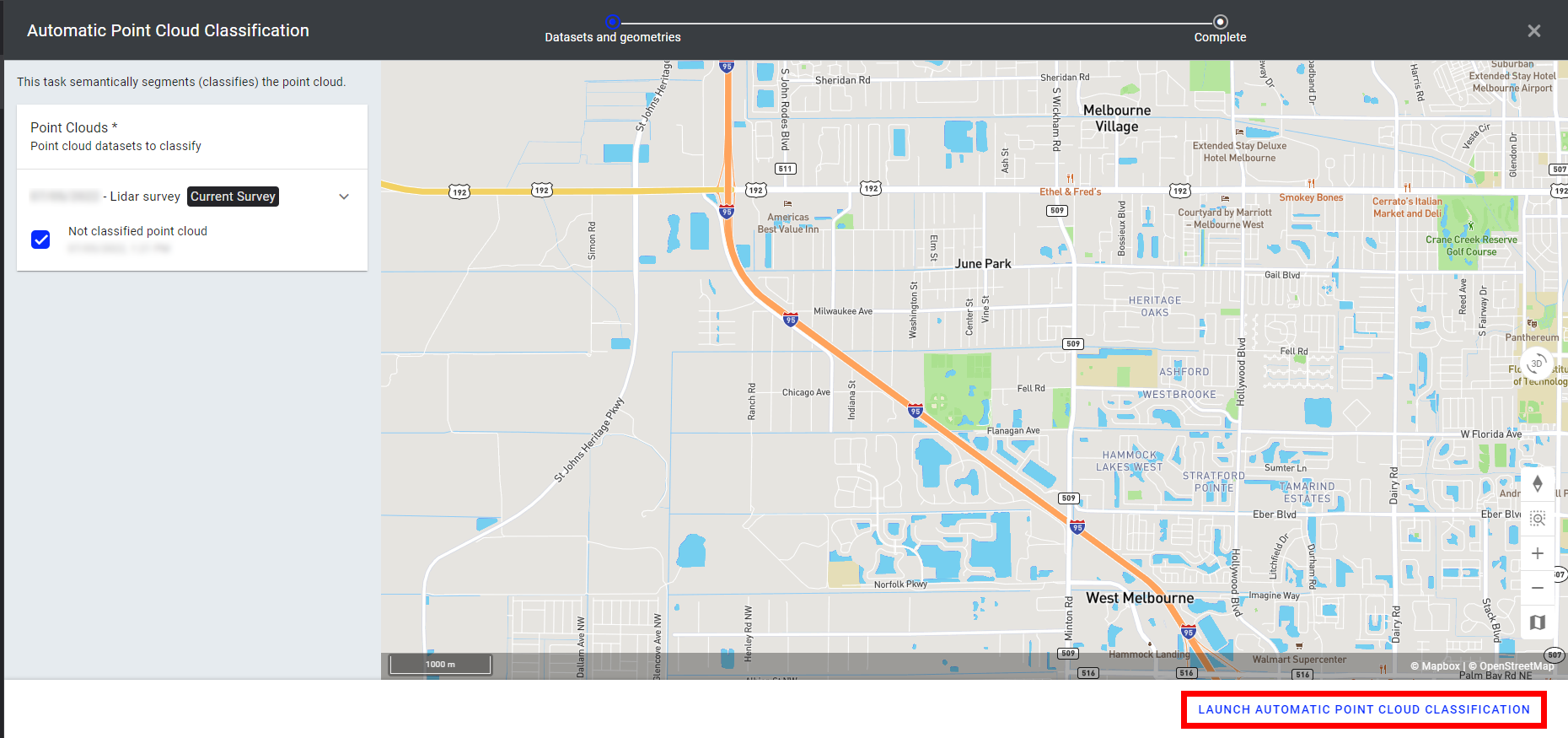
Step 5 - Click on "FINISH".
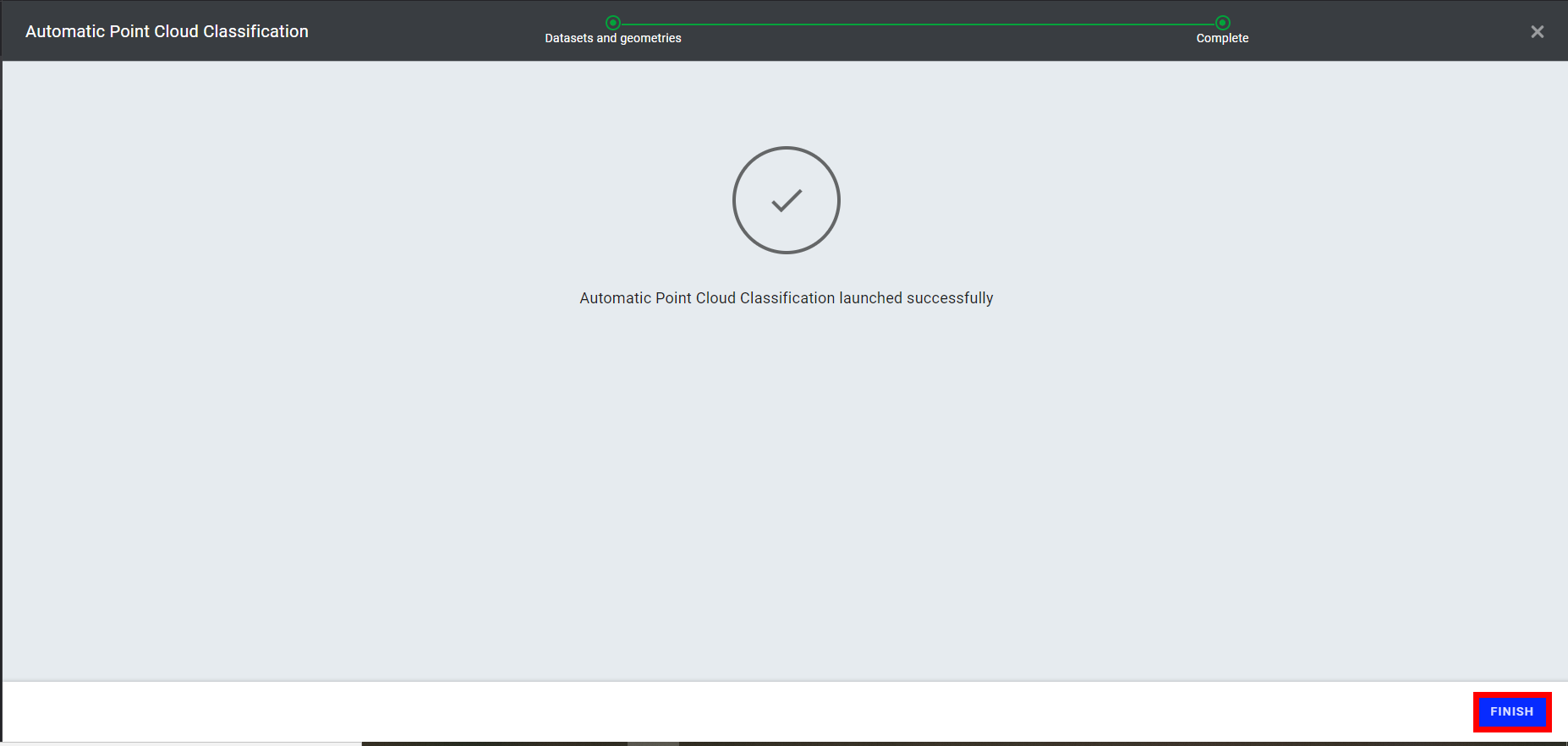
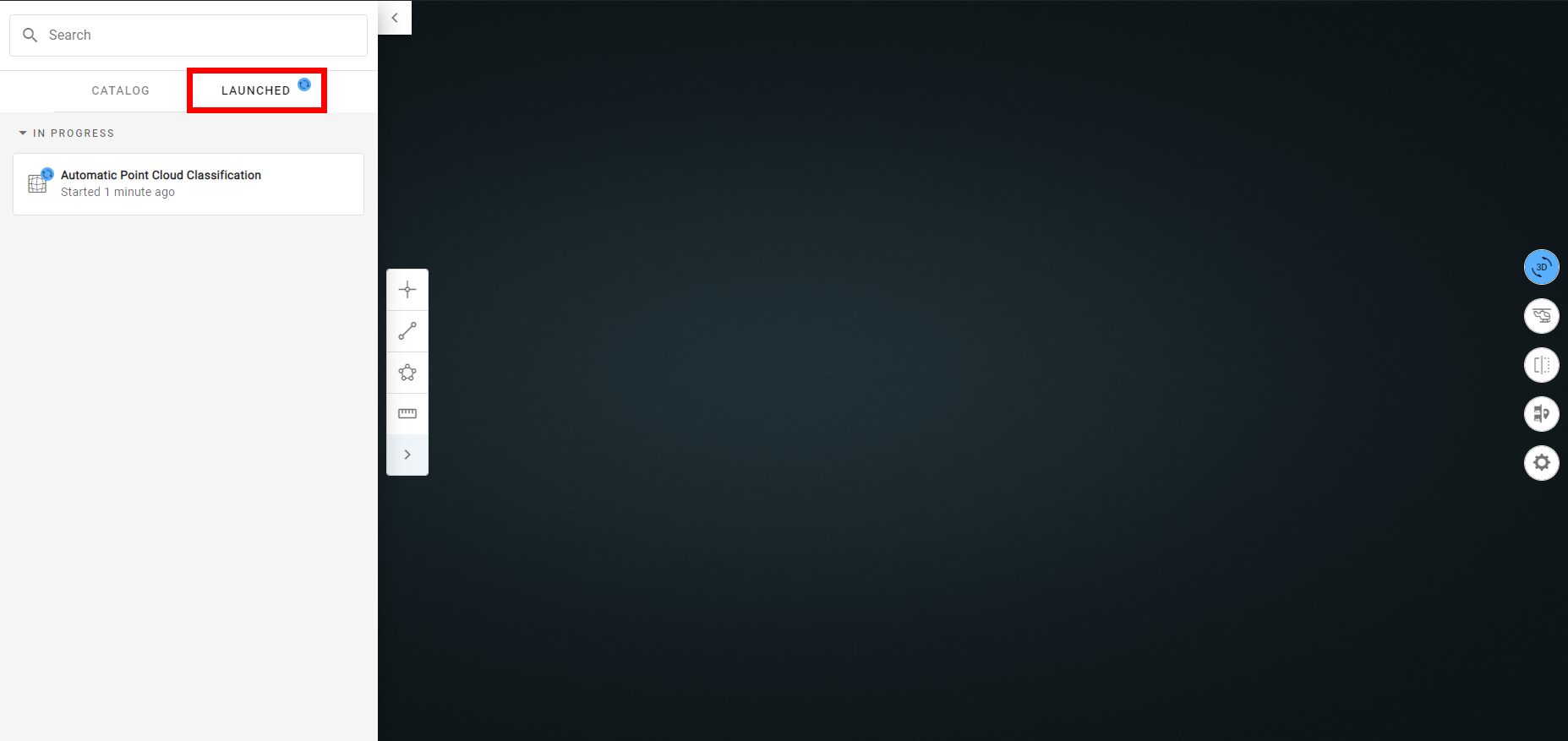
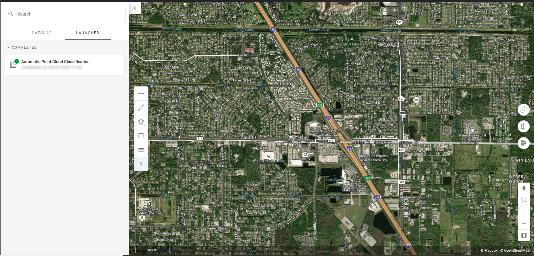
Step 7 - Once completed, the point cloud classification will appear on the list with a green checkmark. Additionally, a notification is sent that can be found in the notifications icon in the top-right corner.
4. Results
4.1 Browsing the classified point cloud
To view and interact with the point cloud classification, change the view from 2D to 3D, and select 3D from the viewing menu.
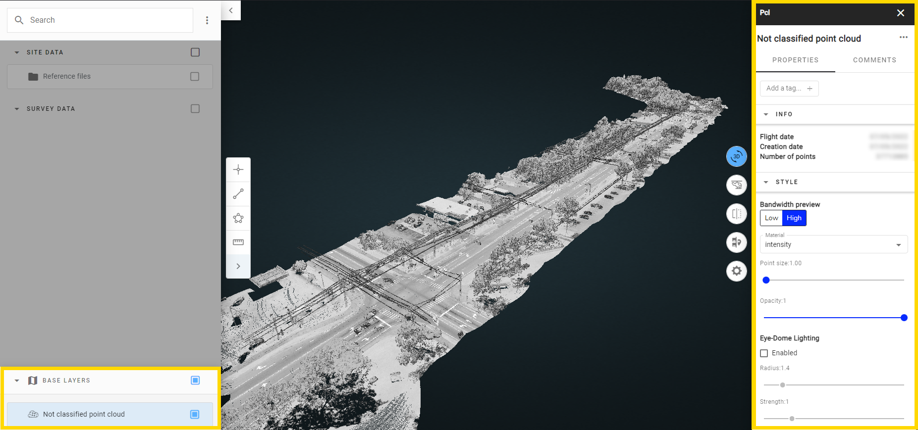
Then, from the in-site menu, select "BASE LAYERS" to find the newly classified point cloud. To view it, select the box to the right of the name.

This also opens an information panel on the right-hand side of the screen. Under "CLASSIFICATION" there is a color chart that allows the users to quickly scan and identify classes. To further examine the point cloud, use the zoom features to zoom in and out.
4.2 Output classes
In the output, seven classes are obtained.
| Class | .Ias Class Number |
| Unassigned | 0 |
|
Ground |
2 |
| Vegetation | 4 |
| Building | 6 |
| Noise | 7 |
| Wire - Conductor | 14 |
| Transmission tower | 15 |
4.3 Renaming or deleting the point cloud
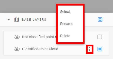
It is possible to rename and delete a point cloud once created. Select "BASE LAYERS", locate the point cloud, and select its 3 points menu. Three options appear: "Select", "Rename," and "Delete."
4.4 Possible errors and limitations
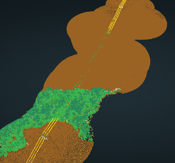
For point clouds containing zones with a very low point density, there may be some locally improperly classified items. In the below example, a portion of the power lines appear green, indicating they are classified as vegetation. Thus, for maximal results, ensure to provide dense enough point clouds. We suggest a minimum density of 20 pts/sqm to properly detect conductors.
5. Exporting the point cloud
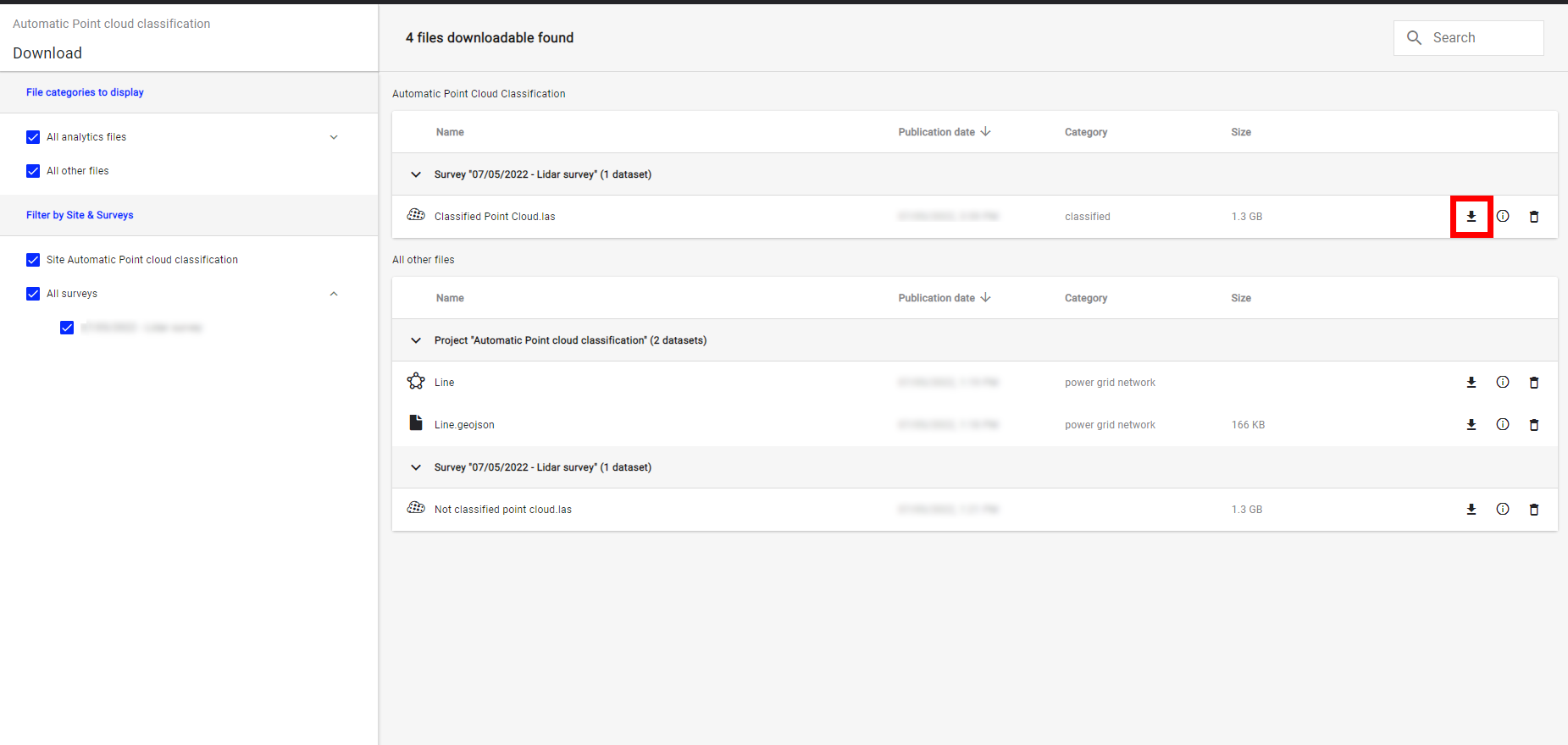
It is possible to export the point cloud for third-party usage, once it is created. From the menu on the left-hand side, select the downloads icon.
Under the survey in which it was created, locate the point cloud classification and select the download icon to the right.
